More Additions To Google maps

Google maps feature can now predict how crowded your train will be and bud delays.
Reports of crowdedness from Google Maps users from October 2018 to June 2019 during peak commuting hours (6am – 10am), was analyzed and identified which lines had the highest number of crowdedness reports. Here’s what they found:
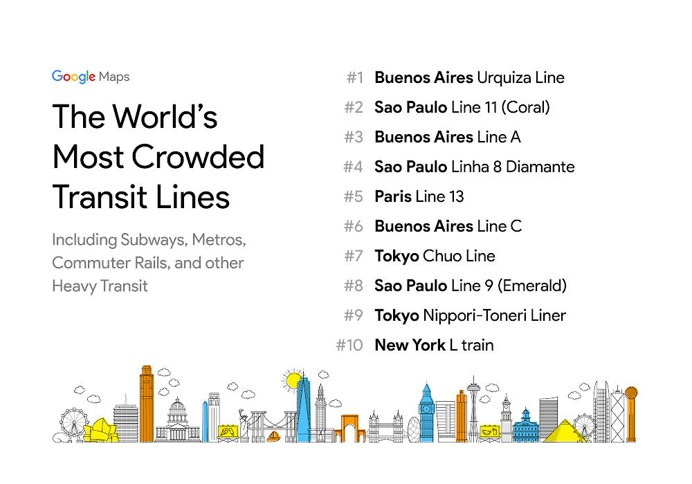
- Buenos Aires and Sao Paulo dominate the rankings–each city has 3 lines in the top 10.
- New York’s L train–which, until recently, was on the verge of closing for repair– is the only U.S. transit line to make it into the top 10.
Traffic delays for buses
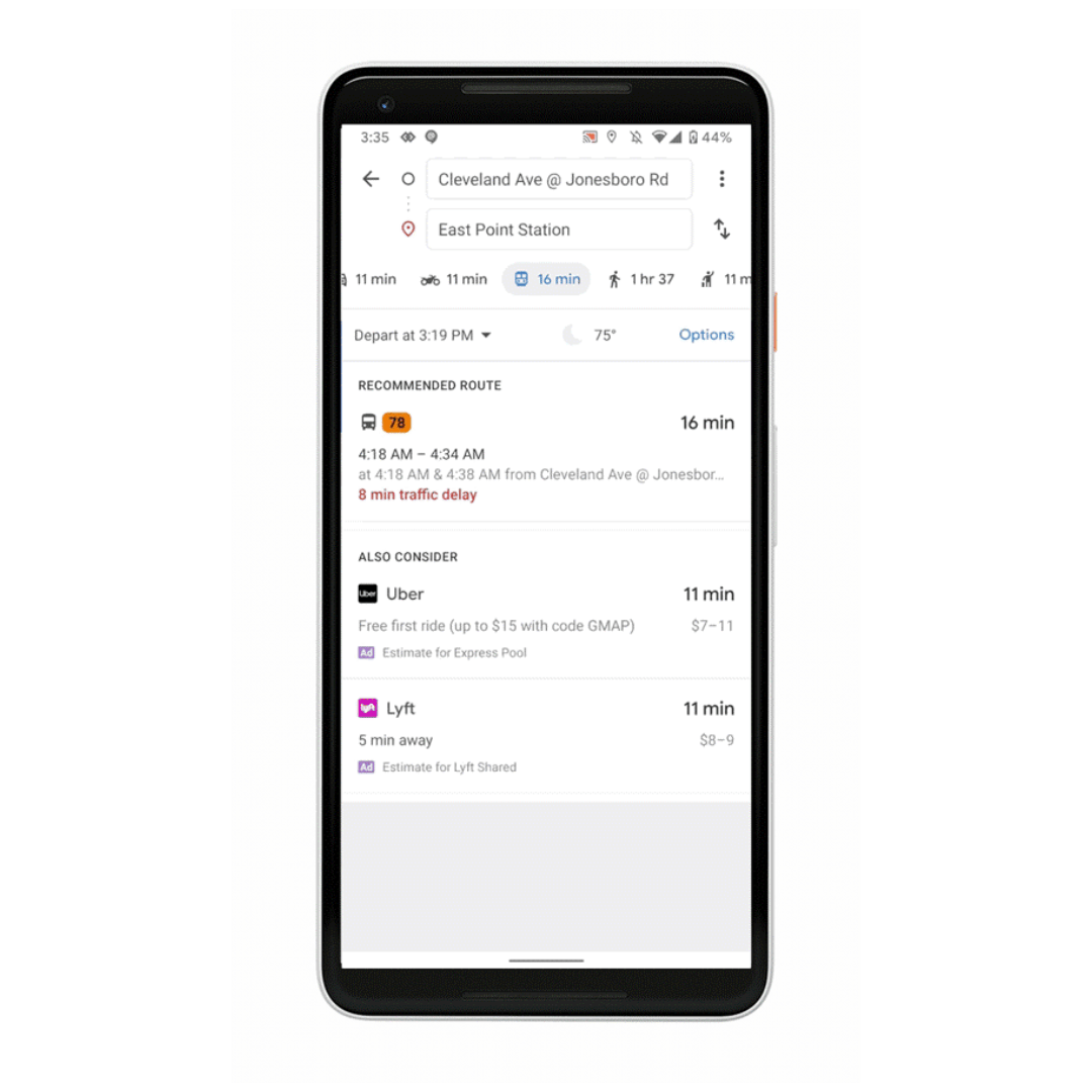
Google Maps can now tell you about your bus travel times based on live traffic. This uses the power of Google’s live traffic data and public bus schedules to calculate delays and provide accurate travel times. This is the first product of its kind — launching first in India; Will soon expand to other cities.
Google maps will also let you know when your train will be arriving.


You must be logged in to post a comment.